![[SBS Good Partner] ‘New Start’ Who is the first client that Jang Nara faces?](https://kroamer.com/upload/trending/thumb-T9B1726187910749_600x2185.jpg)
No. 18 Typhoon Mitag, Current Location Latitude-21.6˚N, Longitude-123.0˚E!
2019-09-30 14:31:26
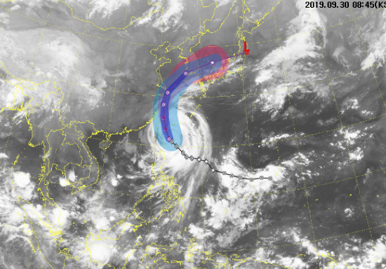
The 18th Typhoon Mitag (MITAG), which originated in the far sea of Guam around 9 am on September 28, is heading north, attracting interest in the travel route.
No. 18 Typhoon Mitag (MITAG) is a medium to medium-sized force with a mid-pressure of 975 hectopascals (hPa), maximum wind speed of 32m / h (115km / h), and a strong wind radius of 320km (9.9 km) as of 9 am on September 30.
Passing about 500km near sea (latitude 21.6, longitude 123.0), it is advancing northwest west at a speed of 21km per hour.
No. 18 Typhoon Metak was 9:00 hectares of central air pressure at around 9 pm on the 30th, the maximum wind speed near the center of 133 km per hour, and the strong wind radius of 330 km.
It is expected to.
Typhoon Metak continued to land in the mid-class, at 9 am on October 1, landing on land around 340 km south of Shanghai, China, and then heading north on March 3 at about 9 km north of Mokpo.
It is expected to be.
The path of the typhoon is more than expected, and the forces are likely to weaken as it passes through the Shanghai land. In the afternoon of October 3, when it approaches nearby Mokpo, Gwangju, Busan, Ulsan, and Daegu, the strong wind radius reaches 250km.
The whole area seems to be in a hurricane radius, which is a great concern.
No. 18 Typhoon Mitag (MITAG) is the name of a woman submitted by Micronesia, and the Meteorological Agency said that the location of the typhoon may be fluid after 4 or 5 days.
This year, 17 typhoons have occurred.
Six of them scrambled Korea directly or indirectly.
Since 1951, the year that Korea was most affected by typhoons was 1959, and a total of seven landed or approached the Korean Peninsula.

![[SBS The Story of That Day] A good son sentenced to 100 years in prison](https://kroamer.com/upload/trending/thumb-loI1726126533731_600x750.jpg)


![[SBS Judge from Hell] 4th teaser, Park Shin-hye](https://kroamer.com/upload/trending/thumb-1oA1726190224411_600x780.jpg)